
Payment & Security
Your payment information is processed securely. We do not store credit card details nor have access to your credit card information.
Description
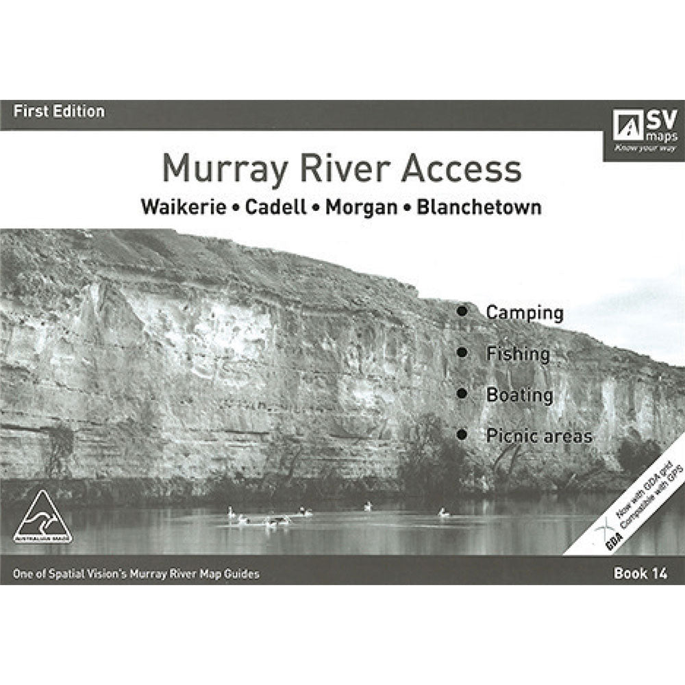
Spatial Vision's series of Murray River Access Maps are the best way to find camping, fishing and boating spots along the Murray River.
Also includes information on parks and forests, and major walking tracks.
SCALE: 1:25,000 COVERAGE: Waikerie, Cadell, Morgan, Blanchetown
Product Specifications
- Designed for visitors touring the area
- The guide has been produced with the support of Moira Shire, Park Victoria, Forests NSW and local businesses.
- The Murray River Guides are a great way to find the best camping and fishing spots
| Length : 29.7 cm | Width : 21 cm |
| Height : 0.5 cm |


Easy Returns
Free 365 Day Warranty

Shop & Pay in your currency
Now shipping to 40+ countries

100,000+ Products
Amazing Brands. All Gift Occasions.
Related Products
Top Selling Items
Save 20%

Save 15%


Trending Products
Save 18%

LatestBuy
What We Do In The Shadows Guillermo Pop! Vinyl
Sale price$17.99
Regular price$21.99
In stock
Save 20%


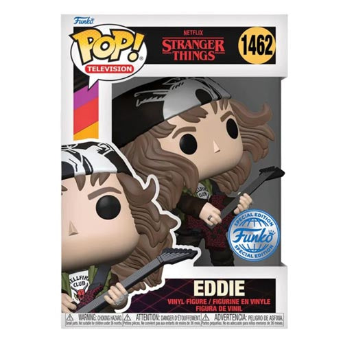
Stranger Things
Stranger Things Hunter Eddie w/ Guitar US Ex. Metallic Pop!
Sale price$25.99
In stock
🛒
BUY MORE SAVE MORE!
Save 65%